
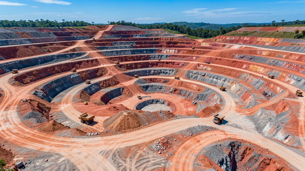
Pit modeling in AutoCAD Civil 3D is an essential skill for mining and infrastructure engineers working on open pit projects in Brazil. Autodesk software offers robust tools to create accurate topographic surfaces, design geometrically secure berms and slopes, and integrate drainage systems that ensure excavation stability. This guide covers the main techniques and workflows for those who want to master pit modeling in Civil 3D.
What is a Cava and How Civil 3D Facilitates Modeling
A pit, also known as an open pit, is an open pit excavation carried out to extract ores or move materials. Unlike conventional cut and fill, the pit requires detailed geometric planning with multiple bench levels, access ramps for equipment, and surface and subsurface drainage systems.
AutoCAD Civil 3D stands out in this scenario by offering parametric modeling based on TIN (Triangulated Irregular Network) surfaces, which automatically update as design parameters change. This allows the engineer to experiment with different pit geometries and quickly evaluate excavation volumes, slope slopes and haul distances.
- TIN surfaces: Creation of digital terrain models from topographic surveys, contour lines or point clouds
- Alignments and profiles: Definition of access ramps with vertical railings and curves that respect the equipment fleet
- Volume calculation: Comparison between original surface and designed surface to quantify excavated material
- Corridors (corridors): Continuous 3D modeling of shoulders, embankments and work platforms
Essential Techniques for Pit Modeling in Civil 3D
The geometric modeling of a pit begins with defining the upper perimeter of the excavation, followed by the projection of the intermediate slopes and the final floor. Each bench level requires special attention to berm width, slope angle and step height — parameters that vary depending on the type of soil or rock and the mine's safety requirements.
To create safety berms, use Civil 3D's grading tool, which allows you to precisely define slopes and extensions. Access ramps must be designed as separate alignments, with sufficient width for off-road truck traffic and a maximum recommended slope of 8% to 10%, depending on the size of the operation.
- Base surface: Import topographic data (COGO points, contour lines or LandXML file) and generate the starting surface
- Projection lines: Draw the perimeter of each berm using 3D polylines with dimensions defined by longitudinal profile
- Intermediate slopes: Apply the slope tool between consecutive berms at angles of 45° to 70°, depending on the material
- Access ramps: Model as horizontal alignment + vertical profile + cross section assembly with defined width and slope
- Volume check: Use the Volumes Dashboard command to compare the final surface with the original and extract reports
Drainage and Infrastructure in Pit Projects
A complete pit design is not limited to excavation geometry. Surface drainage is critical to avoid water accumulation on work fronts, which can compromise slope stability and equipment productivity. Civil 3D allows you to model drainage channels, containment basins and subsurface drainage systems integrated into the surface of the pit.
Use the detention basin tool to size reservoirs that capture rainwater runoff from verges and embankments. Design channels along the safety shoulders, with a minimum slope of 0.5%, directing the water to the exit points. For more advanced projects, combine pit modeling with the Storm and Sanitary Analysis module, which performs full hydrological simulations.
- Drain channels: Model as alignment with profile and assembly in trapezoidal or rectangular shape
- Containment basins: Position at low points on the perimeter of the pit with a volume sized for critical rain
- Subsurface drainage: Install deep horizontal drains on slopes to relieve pore pressure
- Integrated system: Connect all elements to the MDT (Digital Terrain Model) for 3D visualization
Purchase AutoCAD Civil 3D through CanalVIP
Pit modeling in AutoCAD Civil 3D is a strategic skill for engineers working in mining and infrastructure in Brazil. With the right tools and the appropriate workflow, it is possible to reduce project deadlines, increase the accuracy of calculated volumes and guarantee the operational safety of the excavation. Check it out on CanalVIP catalog licensing options for AutoCAD Civil 3D and other Autodesk software for your team.